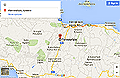
Location of Agioklima on Crete
At the top of the hill, at an altitude of 340 meters north of the traditional village looking over the Cretan Sea, west and south to the mountain Psiloritis and traditional villages Pendamodi and Krousonas. Distance from the city of Heraklion is 16 km.
To the University of Crete, ENISA and FORTH 6 km, and is the crossroads of the province Malevizi. Starting from village Petrokefalo the left path leads to the historic village of Agios Miron – ancient Rafkos – within 6-7 km of the Lower and Upward Assites, the historic monastery Gorgolaini, but here we find the E4 European path to the mountain refuge Prinos.
3Km after Assites will take you to Prinias and excavations of ancient Rizinia having your feet of the Messara as beyond the Phaistos and Gortyn. And all in the peaceful countryside of the province Malevizi – Toscana of Crete, at the Venetians – with vineyards, historic monasteries and small churches, full of olive trees and, of course, very hospitable people.


If you like walking, then Agioklima and Petrokefalo is a good starting place. Some routes are leading strait from Agioklima garden down into the valley. With beautiful spots to stop and drink from the church well or have a chat with one of the locals on the fields.
If you love reading, or you are a writer, here is the place you are looking for.
On Google map